Development and evaluation of an open dataset for vegetation cover fraction in each town block across Japan using Google Earth Engine
 Vegetation cover fraction dataset for Japan
Abstract
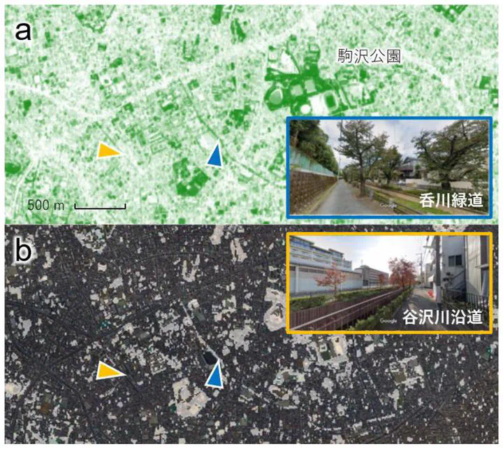
Although the percent of green space is the most frequently used index for quantifying urban green, it is currently unavailable in most cities in Japan. Here we provide an open dataset of the index for each town block across the country based on Sentinel-2 satellite images in Google Earth Engine. The dataset is calibrated and validated with airborne datasets obtained in nine cities in Tokyo. The precision of our dataset is 2.8%pt in RMSE for eight cities out of the nine. One exception shows significant bias, but it is most likely due to differences in the definition of green space.
Type
Publication
AIJ Journal of Technology and Design, 28(68), 521-526
Click the Cite button above to demo the feature to enable visitors to import publication metadata into their reference management software.